
With the aim of preventing catastrophic flood events, the Project for the improvement of non-building flood risk management measures in the Republic of Croatia was conceived, which will improve water and ecological monitoring, analysis and solutions (acronym VEPAR).
An integral part of the subproject Improvement of the system for monitoring and maintenance of regulatory and protective water structures (RIZVG) is Preliminary categorization of embankments on watercourses of the 1storder (hereinafter: PKN).
The goal of the preliminary categorization of the embankment was, based on the activities carried out and the collected data, to make an analysis and assessment of the condition of the embankment with the definition of priority sections and recommendations for further actions in the next phase of the project (regular and enhanced maintenance / detailed categorization / investigative works / installation of equipment with geotechnical measurements / geotechnical analyzes and calculations / rehabilitation).
The PKN project treated 1,748 km of embankments.
The activities envisaged by the Preliminary categorization of embankments on the 1st order watercourses were:
- Collection, processing and systematization and analysis of existing data
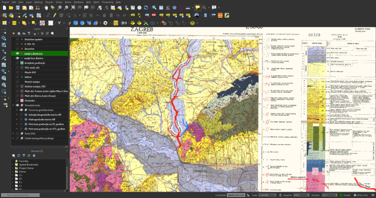
Relevant geotechnical data were processed from the collected investigation works and systematized into a database of existing investigation wells. As part of the activity, thematic maps were also used that were georeferenced and introduced into GIS (topographic maps, geological and hydrogeological maps, and maps of earthquake areas).
- The preliminary categorization of the embankment included the following activities
- Creating a digital field data collector in an android application – offline dana collecting (ODK)
- Preliminary categorization based on visual inspection of the embankment – (field data collection)
- Synthesis, processing and analysis of data – creating a GIS project of preliminary categorization of embankments in QGIS
- Evaluation of the embankment condition with recommendations for further actions
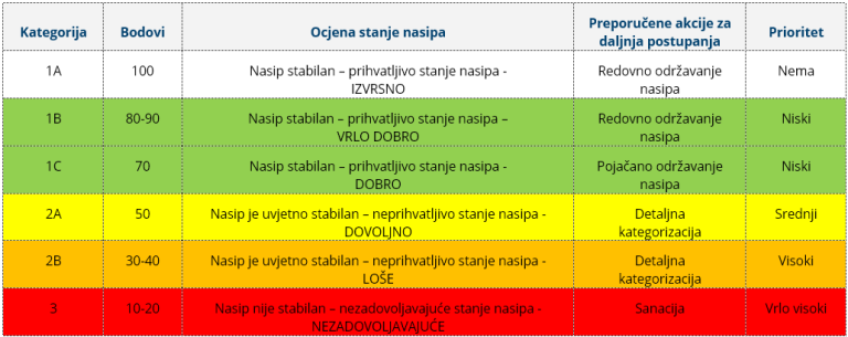
The assessment of the condition of the embankment resulted from the categorization of individual hazards (categories I, II and III). Categories are assigned colors that suggest the importance and priority of further actions (from green to red).
- Development of a program of geotechnical investigation works based on existing data and preliminary categorization of embankments
- Implementation of geotechnical investigation works which consisted of:
- Field exploration works – exploration drilling, exploratory excavations, CPTU and DPH sounding, geophysical exploration works
- Laboratory tests
- Installation of equipment for geotechnical measurements
- Professional management of investigative works
- Geotechnical measurements on installed equipment
- Preparation of a report on the preliminary categorization of the embankment, a synthetic report on the existing and conducted geotechnical investigation works, and a report on the conducted geotechnical measurements.